Weather: Cloudy, then fine
We had breakfast from 6.30am at the dining room at Koiji. The innkeeper's husband made a brief appearance before heading off to work, scoffing down a piece of toast with jam and a cup of instant coffee while we dined on a traditional Japanese breakfast, including grilled salmon, miso soup, and rice. At 7.15am the innkeeper drove us back to the station, again saving us a long walk.
The first leg of the day's journey to Agematsu was pretty uneventful. We had a break at Suhara before tackling the only ascent of the day. We passed several other walkers, but none seemed overly keen to talk to us. For much of the day we were walking along a busy motorway. It was quite narrow at times, which was a bit scary as there seemed to be more trucks than normal using this stretch of road.
 At Agematsu we had lunch at a small coffee shop. The menu was pretty limited. I chose the shrimp pilaf, and Erik the mixed sandwich. Soon after we ordered, I noticed the woman who was running the coffee shop whisper in the ear of a patron at the counter. He went out and came back a few minutes later with a loaf of bread. I guess they don't get too many orders for the mixed sandwich!
As we continued to climb up the Kiso Valley the autumn colours became more pronounced. We'd planned the walk in such a way that we were guaranteed to see some of Japan's famous autumn colours at some point along the journey, and as luck would have it we ran into them in one of the most picturesque parts of the country.
 We arrived in Kiso-Fukushima just after 3pm and got directions to our ryokan from the tourist information office across from the station. I had a craving for some cake, so we also got a recommendation for a nice coffee shop. Unfortunately the cake at the place we were directed to was straight out of the freezer, although it was quite tasty and the coffee was good.
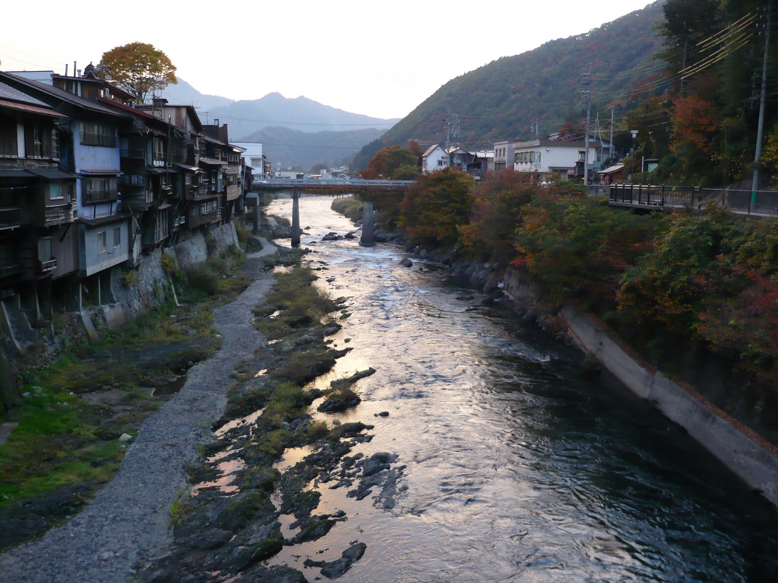 We then checked in to our ryokan, which was right beside the Kiso River (in fact the noise of the water kept me awake that night). Erik suggested we go for a walk. On the way back from our stroll through the old part of town we were treated to a magnificent sunset.
 Back at the ryokan, we bathed before heading down for dinner at 6.30pm. At the end of the meal we had a brief chat with the "mama-san", a bubbly woman (in contrast to her husband, who came across as rather dour) who was eager to practice her English.


3 comments:
Been enjoying your journey so far, sounds like it was quite an experience...
Kerry
Hi, I'd like to walk between Shiojiri and Magome during Golden Week. The photos and description of this area seem the most interesting part of the walk. Would you recommend any other places or skipping any particular parts of the route? I'd rather avoid walking along too many highways and am happy to hop on a train or bus if the road walking becomes a bit dull. Also, could you recommend any guidebooks or maps for the route. Thanks for your time......
Hi there
If you don't like highways, I would skip the section between Shiojiri and Nagiso, and instead add the section between Magome and Nakatsugawa on the other end. That would make the total distance something like 18km. There was a good information center in Nagiso which had hiking maps. Don't know if it's still there though.
The hike over the Torii Pass from Narai to Yabuhara is nice, and would also give you a chance to see Narai if you haven't been there. It's only 5.5km though.
Another nice walk is from Ena to Mitake, which passes through the old post towns of Okute and Hosokute. In Hosokute there is a wonderful old ryokan called Daikokuya:
http://hosokutedaikokuya.web.fc2.com/main/index.html
Between Ena and Mitake is about 30km. There are train stations at either end.
There are several guidebooks in Japanese covering the entire Nakasendo. Two I know the names of are Nakasendo wo Aruku and Nakasendo 69 Tsugi wo Aruku.
Here is a site with the route plotted using Google Maps:
http://www5.big.or.jp/~ejiri/nakasen/map/
Finally, there is a good stage-by-stage English commentary on the Nakasendo with lots of historical info here:
http://www.nakasendoway.com/?page_id=95
Hope this helps.
Post a Comment