Tuesday, 21 October 2014

Day 7: Imaichi - Nikko

Distance covered: 8.5 km
Weather: Cool and cloudy with drizzle


After a well-earned sleep-in, I got up at 7 am and checked my toe. It was fine. I showered, shaved and dressed and headed down to the restaurant for breakfast. Now I've had some wonderful buffet breakfasts over the years. The breakfast at the Amari Koh Samui hotel was so beautiful I videoed it and set it to a Mozart violin concerto. The Amari Phuket breakfast was probably even more lavish. They even had porridge! While nowhere near as impressive as the breakfast buffets at these Thai hotels, the spread at my hotel in Kinugawa Onsen was definitely a step up from what I had experienced at the other hotels I stayed at along the Nikko Kaido. The waitpersons were also a lot nicer. After being shown to my table, I went and toasted some wholegrain bread (sans pink swirls) on top of which I piled a couple of spoonfuls of scrambled eggs. I then filled a bowl with cereal, fruit, fruit juice, yoghurt and milk. When I finished eating this, I got a couple of pastries to have with my second cup of coffee. There were others things available, including waffles, but seeing as I was staying here three nights I decided to leave those for another day. On my way out, I asked at reception if I could change rooms. Though I had asked for a non-smoking room, the one they had put me in smelled of cigarette smoke.


I left the hotel at around 8:30 wearing my rain gear and with my bum bag around my waist but without my pack. I caught the 8:50 train back to Shimo-Imaichi and rejoined the Nikko Kaido where I had left it the previous day. There was another long avenue of cryptomerias, followed by a short stretch of narrow road clogged with cars and trucks. Unusually, there was no footpath here, making it quite unpleasant to walk along. As I approached Nikko, a man coming in the other direction stopped and asked me if I was lost. Nikko is a popular tourist destination visited by lots of foreigners, but I guess not many of them venture out this way. We chatted for a bit, and he told me he was a kind of self-appointed volunteer guide who liked helping foreign tourists find their way around. Before we parted, he gave me a detailed map of Nikko, which was helpful since my walking map only showed the parts of Nikko adjacent to the Nikko Kaido.


I arrived in central Nikko at around 11 am and had lunch at a restaurant near Tobu Nikko Station. After lunch I walked the final few kilometres of the Nikko Kaido to its end point by the Shinkyo Bridge. This final stretch was uphill, but it wasn't too steep. I took a bunch of photos of the bridge before climbing the hill on the other side of the bridge to the Toshogu Shrine. By this time the drizzle had stopped, but there was low cloud all around me, producing quite a mystical atmosphere. The autumn colours were also nice, though I had read reports that they were even nicer around Senjogahara, where I was planning to head the following day. 


Toshogu shrine is the final resting place of Ieyasu Tokugawa, the founder of the Tokugawa shogunate. Like military strongmen and dictators the world over, Ieyasu was cruel and ruthless. But the Edo period (1603-1868), which he founded and which his clan ruled over for two and half centuries, is one of my favourite periods in Japanese history. It was during the Edo period that many aspects of Japanese popular culture that I admire, including woodblock prints, or ukiyoe, flourished. And it was Ieyasu who ordered the construction of the Nikko Kaido and the other routes that make up the Gokaido. In short, if it had not been for Tokugawa Ieyasu, I probably wouldn't have become interested in Japan, nor would I have thought of walking the Gokaido, which wouldn't have existed anyway! These were some of the thoughts that went through my mind as I wandered around the Toshogu with the hundreds of other tourists, both Japanese and foreign.


Later in the afternoon, I walked back to Tobu Nikko Station and caught the train back to my hotel at Kinugawa Onsen. That night I dined at a nearby Gusto restaurant. Back in my hotel room, I quietly celebrated the completion of my fourth epic walk in Japan with a can of Sapporo beer and some scrummy mix.


The End

Monday, 20 October 2014

Day 6: Utsunomiya - Imaichi

Distance covered: 27.2 km
Weather: Fine then cloudy then rain


Things got off to a bad start on day 6. As I queued for breakfast, the old man just ahead of me fumbled his tray and almost dropped it, spilling miso soup all over the floor. He was gutted, and I felt so sorry for him as he apologised to all and sundry. But worse was to come! There were no egg dishes, and I arrived at the toast station to find not normal bread, but slices of what looked like cake with swirls of pink through them. When I asked one of the dragons on duty if they had any normal toast bread, she replied curtly, "That is normal toast bread." As I feared, the pink swirls tasted of strawberry. Yuk! The coffee ("espresso" from a machine) wasn't much better.

By the time I left the hotel it was rush hour. Of course, rush hour in Utsunomiya is nothing like rush hour in Tokyo, and having spent most of the previous five days walking alongside a busy highway, I was used to the traffic. But leaving Utsunomiya, I found myself on a series of narrow streets with a steady stream of cars coming the other way and no footpath. At one point I was nearly hit by a car whose driver noticed me just as he was about to turn onto the road from a side street.


Once I was out of the central city, things got a lot better. It wasn't long before I encountered the first of several avenues of towering cryptomeria trees I would pass today. Like the avenues of pine trees on the Tokaido, these were planted in the Edo period to provide shelter for travellers. Where these avenues survive, the width of the road is limited to the space between the two rows of trees. The footpaths run along the outside of the rows, meaning walkers are well separated from the traffic. 


With a search on Google Maps earlier in the day indicating that there were likely to be few restaurants along today's route, I decided to buy lunch at a convenience store. I got a couple of rice balls, a corn roll, a slice of fruit loaf and some iced coffee and had lunch sitting by the side of the road. Nearby some farmers were harvesting their rice. I was enjoying my picnic, but by this time it was starting to cloud over, and not long after I got underway again it started to rain. It drizzled on and off for the rest of the day - not the most pleasant of walking conditions, but I was still able to take some photos.


Unfortunately, in some places, the exhaust fumes and vibrations from the constant flow of vehicles is having a detrimental effect on the cryptomerias, and to prevent further deterioration there are plans to reroute traffic away from the trees and restrict access to the space between them to cyclists and pedestrians. These plans have been implemented in two or three places, and it was a real joy to experience walking under the massive trees just like in the Edo period. And they did provide some welcome protection from the drizzle.


I was enjoying myself so much that I lost track of the time. I had booked a hotel in the nearby hot spring resort of Kinugawa Onsen. To get there I had to catch a train from Shimo-Imaichi, which was still a couple of kilometres up the road. The trains ran every hour or so, and when I checked the time and the schedule I realised there was one leaving in a few minutes at 2:45 pm. Could I make it? I set off at a brisk pace. I even thought about running, trying to remember how long it took me to run 5km when I was doing so regularly a few years ago and then dividing that time by two or three or... But I quickly realised I had no hope of making it to the station in time, and so I slowed down and tried to relax and enjoy the scenery again. I arrived at Shimo-Imaichi at 3.15, and had a long wait before catching the train to Kinugawa Onsen at 3.50.

It was just a few minutes walk from the station to my hotel. It was quite luxurious compared to the places I had stayed at so far. The only drawback was the lack of wi-fi in my room. I was booked to stay three nights. Tomorrow I would walk the remaining 8.5 km of the Nikko Kaido and then explore Nikko itself. The day after I planned to hike the Senjogahara marshlands, something I had long dreamed of doing. Unfortunately the weather forecast wasn't that great. Also, when I took of my shoes I discovered a sizeable blister on the side of my big toe. Would I be able to complete the walk? Or would disaster strike at the last minute?       


Sunday, 19 October 2014

Day 5: Oyama - Utsunomiya

Distance covered: 29.8km
Weather: Fine

Aware that today was going to be my longest day, I set off early (7.30 am) and at a fast pace, determined to knock off as much distance as possible while it was still relatively cool. I covered 5km in each of the first two hours, slightly less in the third. The scenery was noticeably more rural than yesterday, but once again I spent most of the time on the familiar - and busy - Route 4.

At Koganei I came across a nice pair of ichiruzuka, or route markers, and stopped to take some photos. One of them even turned out alright!


I arrived in Ishibashi around lunch time and left the Nikko Kaido to check out the area around the station, thinking there would be a good place to have lunch. There wasn't. Noticing there was a local fair going on up the road, and wondered around for a bit before rejoining the Nikko Kaido. Not long afterwards I came to a McDonalds. Yes, I know. Inside, I wolfed down a shrimp burger and a Fillet-o-fish, then had a coffee (the food may be crap, but the coffee at McDonald's - at least in Japan, which is the only place I've been to McDonalds in recent years - is surprisingly good).


Soon after setting off again I passed the first of two huge Japan Self Defence Force bases. I was tempted to take some photos of the lines of military vehicles, but decided the risk of being mistaken for a foreign spy wasn't worth it.


I reached the outskirts of Utsunomiya, the capital and largest city of Tochigi prefecture, around 2.30 pm. Check-in at my hotel wasn't until four, so I killed time at a Saizeriya, where I indulged in more coffee and a dessert of ice cream, walnuts and chestnuts - yum!


After several days hiking through the countryside, it was a bit of a novelty to be in a relatively large city, and so once I'd checked in I went for a wee wander around the central city area. There had been a big international cycle race on earlier in the day, and there were lots of cyclists around. On my way back to my hotel I stopped at a Fujiya restaurant for dinner. The oyster and prawn spaghetti dish arrived with lots of little pieces of ham on top. Apart from that it was delicious.      


Saturday, 18 October 2014

Day 4: Koga - Oyama

Distance covered: 16.5km
Weather: Fine and warm

This morning I slept until 6am, a sure sign that my body clock had finally adjusted to Japanese time (until today I'd been waking at between 3 and 4am). I got down to the restaurant at 7am to find it already full. The food was OK, but the coffee was the worst I'd had for some time.

Today I was to have company! Mr Iwakawa, who stayed with us in Christchurch earlier in the year while traveling around New Zealand, was meeting me at Koga Station. I got there early and wandered around for a bit. In front of the station I spotted something unusual, even for Japan, where vending machines are ubiquitous: an umbrella vending machine.


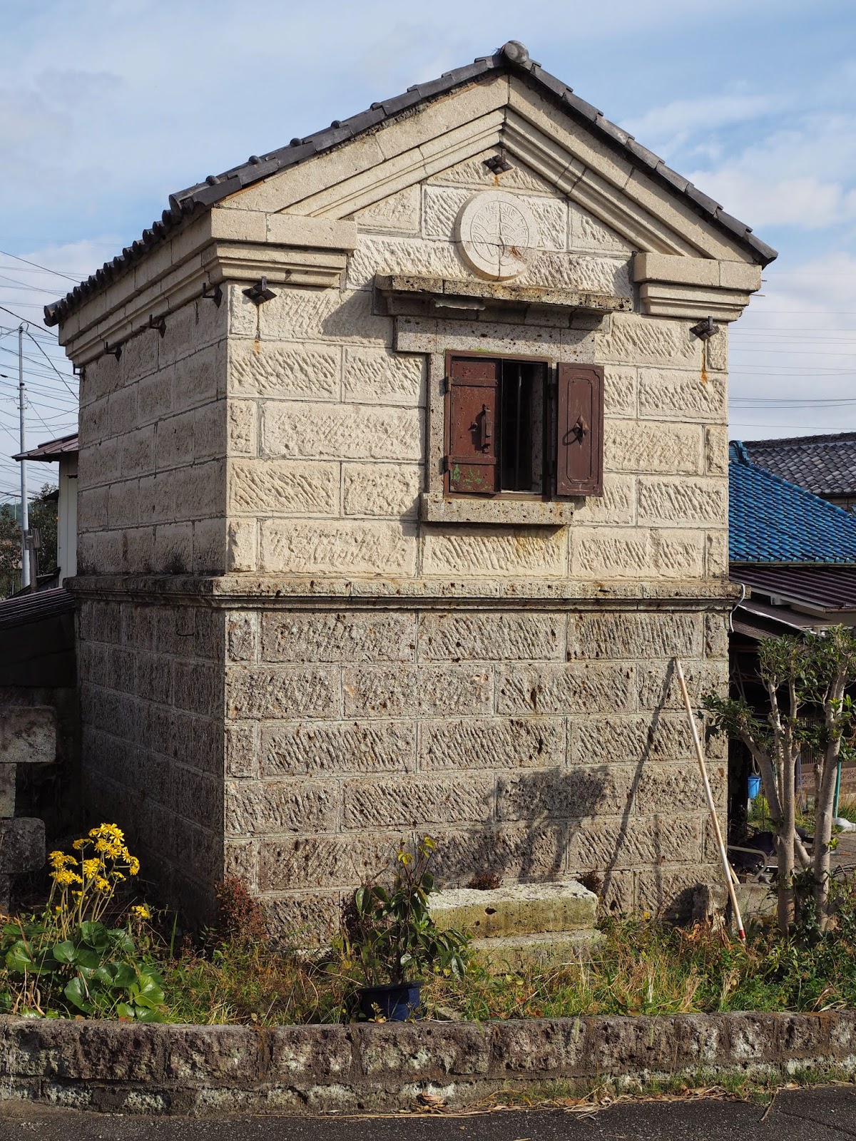
Mr Iwakawa arrived on time at 8.34am. Since we only had 6.5km to walk, we decided to go and check out the cluster of kura I'd passed the day before. Some of them have been restored to their original condition, while others have been converted for other uses: a restaurant, a hall, and even a rest room! While we were looking around, an attendant invited us to have a look inside one of the restored kura, which was originally used to store rice for use at nearby Koga Castle. It was the first time I'd seen inside such an old kura.


We eventually rejoined the Nakasendo near Koga Station and wandered through the old post town of Koga. At the point where the Nakasendo joins busy Route 4, we came across this structure, modelled on an old lantern.


We followed Route 4 for most of the rest of the day. The scenery wasn't great, but there was the odd reminder of the days of old. Before lunch we passed Mamada-juku, which marks the halfway point on the Nikko Kaido. Cue for a commemorative photo!


We stopped for lunch (rice balls and other yummy Japanese food prepared by Mrs Iwakawa) outside a convenience store just before midday. Later, as we were approaching Oyama, we passed the Wakazakari sake brewery, which is a nationally registered tangible cultural property! This was a cultural experience we weren't going to miss. We went into the showroom and wandered around until one of the staff invited us to taste some of the sake. I thought they'd never ask! After four small cups, I was feeling a bit tipsy. I went off to use the restroom, which was out the back in the brewery complex proper, and on my way back I got a bit lost.


We stumbled on, arriving at Oyama Station at around 2.45pm. After seeing Mr Iwakawa off, I checked in to my hotel. For dinner I went to a nearby Coco's restaurant, where I gorged on a mozzarella and tomato salad, the seafood soup spaghetti (which I first tasted while walking the Nakasendo and which remains one of my favourite Japanese family restaurant dishes), a glass of white wine, and a hot apple pie, which was more like a crumble and came on a hot plate that sizzled when you poured the accompanying caramel sauce over the top (luckily the hot plate had a handy paper "skirt" around the outside that prevented the sauce splattering my clothes - the Japanese think of everything!).

Before going to bed, I turned on the TV and discovered there was a program about the Koshu Kaido, the fifth of the gokaido, or five highways, which I hope to walk in the not too distant future. The producers had roped in three "celebrities" to walk the route relay-fashion, each of them covering around 40km over two days - with varying success.


Friday, 17 October 2014

Day 3: Satte - Koga

Distance covered: 16.5km
Weather: Fine and cool then warm

Breakfast this morning was in the hotel lobby. It was Japanese style, but nothing like yesterday's feast. Instead, a simple buffet with rice, miso soup, salad and not much else. The attendant, perhaps seeing the look of disappointment on my face, approached me and asked if I wanted some toast. "Yes please!" I replied. Moments later he reappeared with two thick slices of white toast bread on a plate. I found some honey and managed to put together a decent breakfast after all, though I don't think I'll ever really get used to salad first thing in the morning.


Post marking the spot where the Nikko Kaido and Tsukuba-do converge

I left the hotel at 8.30am and rejoined the Nakasendo in the old post-town of Satte. Today I only had to walk 6.5km, so I took my time, stopping frequently to take photos with my new camera. The scenery was rather nice for most of the morning. There seemed to be lots of persimmon trees, and I must have spent about ten minutes photographing one little spot, trying to get the perfect persimmon photo. Whenever I see persimmons in Japan I think back to the time while walking the Nakasendo (mentioned here) when I near-toothless farmer presented us with a bunch of persimmons. I don't like them that much, so my walking partner ended up eating them all.


After walking for a couple of hours or so I stopped for a breather at Gongendo Park, which is beside the massive Gongendo levee. The levee was built during the Edo period to prevent flooding, and must have been quite a feat of engineering at the time. Today it's famous as a cherry blossom viewing site. More than a thousand cherry trees have been planted along the levee, stretching for more than a kilometre. Unfortunately they weren't in bloom, but it was still a pleasant place to rest.

Kewpie Mayonnaise factory

Soon after setting off again I spotted a big Kewpie Mayonnaise factory. The sites just kept on coming today! I left the road and scrambled round in the bush trying to get a decent photo of it. Not easy without a telephoto lens.


Further on, just before crossing the Tone River, I came across an archeological dig on the site of the Kurihara sekisho, or Kurihara checkpoint. Like the famous checkpoint at Hakone on the Tokaido and the one at Niegawa on the Nakasendo, this was established to prevent the unauthorised movement of people along the Nikko Kaido during the Edo period. Unlike those two, nothing of the original Kurihara sekisho remains.

Taguchi Shoe Shop

After a late lunch at a Coco's family restaurant (not to be confused with the CoCos Ichibanya curry restaurant chain), I arrived in Koga just after 2pm. It was too early to check in to my hotel, so I killed time by walking around some of the local sites, including the ruins of Koga castle and some nearby kura. I was pretty tired after this, so after checking in I bought some food (deep-fried octopus, sushi) and a large can of beer at a nearby supermarket and had them in my hotel room before going to bed.


Thursday, 16 October 2014

Day 2: Minami-Koshigaya - Satte

Distance covered: 23.7km
Weather: Cloudy then fine then cloudy again


Breakfast at the otherwise unprepossessing Hotel Sun Oak was a delight: a beautifully presented tray of tasty Japanese fare (including a couple of meat dishes, which, being a pescatarian, I didn't touch), augmented in my case by a couple of slices of non-traditional toast and jam and a cup of coffee. Thankfully, there wasn't a raw egg in sight. The other guests were a mixed bunch, including a group of elderly travellers and a couple of Buddhist priests.


I set off at 7.45am. It was cloudy and cool outside, perfect weather for walking. Though later the cloud would disappear and it would get quite warm. For much of the day I was walking along Route 4. It's a busy road but there was a generous footpath and the traffic never really bothered me. The scenery was similar to the day before - lots of rundown, retro-style buildings like those in the photo above. Just before reaching Kasukabe I spotted a Saizeriya and stopped for lunch (if you hadn't realised it before, I'm a sucker for Japanese family restaurants). Kasukabe itself was quite pleasant, with photos in the windows of some of the older shops showing what they looked like in what I guess was the Meiji period.


From Kasukabe onwards the scenery became increasingly rural. There were vegetable plots (including cabbages) and rice fields. I was making good progress, and it looked like I'd arrive at my hotel in Satte before check-in time. Seeing a McDonalds up ahead, I decided to stop for a coffee. I hadn't checked my email or Facebook since leaving Tokyo, and for some reason I assumed they would have free Wi-Fi. Unfortunately they didn't, but I did have a nice chat with an old man sitting at the next table, who saw my backpack and asked me if I was heading into the mountains! He was born in Kagoshima but had moved around Japan throughout his working life. Now retired, he lived in the nearby Satte Danchi. I never got around to asking him how he ended up in Saitama.


Passing Sugito, I came across this monument marking the 36th parallel. The sign nearby informed me that this was the same latitude as Teheran, Nashville and Las Vegas. So there you go. You learn something new every day.


I arrived at my accommodation, the intriguingly named Hotel Green Core +1, just after 4pm. Though there was no Wi-Fi, the receptionist kindly lent me a personal LAN device, and soon after settling in to my room I had it up and running. For dinner I headed back down the road a few hundred metres to a Gusto I'd passed earlier. When I ordered my meal (deep-fried oysters with rice - yum! - and a glass of beer), the waitress asked if I would be alright driving home. I thought this was pretty funny in the circumstances, and an odd thing to ask, but it turns out servers at family restaurants in Japan now ask this of every customer who orders alcohol. 


Wednesday, 15 October 2014

Day 1: Nihonbashi - Minami-Koshigaya

Distance covered: 25.5km
Weather: Cool and cloudy with long periods of drizzle

Two things weighed on my mind as I walked the short distance from my hotel next to Tokyo Station to the starting point of the Nikko Kaido in Nihonbashi: the weather, and my backpack. A few days ago the forecast for the start of my walk was ideal. Yesterday was meant to have been wet and blustery in the wake of Typhoon Vongfong, and the days following that fine. But in fact yesterday turned out to be beautifully fine and only slightly windy, and now it looked as if it was going to rain on this, the first day of my 146km walk from Tokyo to Nikko.


As for my backpack, I'd done absolutely no training with it on, and only minutes ago I'd shouldered it in earnest for the first time since walking the Koshu Kaido four years earlier. Already it was feeling uncomfortable, and I was beginning to worry about what shape I'd be in at the end of the day, let alone after a week of walking.


I arrived at the bridge that gives the Nihonbashi district its name a few minutes before 8am. A couple of friends were going to accompany me on this first leg to Minami-Koshigaya, and as I waited for them to arrive I looked for and found the monument marking Japan's Kilometer Zero. It felt strange beginning my walk from here. On all my previous walks along Japan's Edo-period highways, I'd traveled in the opposite direction (i.e. towards Tokyo), so I was used to ending my walks here.


My companions eventually arrived and after a few commemorative photos we set off. We walked north for a few hundred meters, past the two new Coredo buildings, before turning onto a side street that took us through Nihonbashi's apparel warehouse district. By this time it had already begun to drizzle. I delaying putting on my rain gear in the hope that it would stop, or at least not get any heavier, but after passing Asakusa I relented. It did ease off a couple of times, enabling me to take the odd photo with my new camera, but I ended up keeping my rain gear on for the rest of the day.


Asakusa

I usually only have two cups of coffee a day: one during breakfast and one after lunch. It's a routine I tend to stick to whether I'm at home or traveling. While passing through the flophouse district of Sanya, however, we came across Cafe Bach, which my companions informed me was something of a local institution, so in we went. The coffee took a while to arrive, but it tasted fantastic. The cakes and desserts looked great too, but we resisted the temptation to try them and set off again in the rain.


At around the 10km mark, shortly before crossing the Arakawa River, I noticed an incredible "conestellation" (a term I've coined to describe groups of cones with artistic merit) by the side of the road. Some of them were made by hand from bits of timber and tape! Luckily it was during one of the lulls in the rain, so I was able to take a few photos.


Conestellation near the Arakawa River

On the other side of the Arakawa River we passed a monument to the poet Matsuo Basho, whose route on his famous journey along the "narrow road to the deep north" followed the Nikko Kaido as far as Nikko. Moments later we left busy Route 4 and entered a narrow shopping street that led us past Kita-Senju Station. There were quite a few nice looking eateries along this street, so we decided to stop for lunch, choosing a restaurant specialising in fish. The main dish was great, and the pickles and miso soup some of the best I've tasted for a long time.


We continued north after lunch, stopping now and then to take the odd photo and admire some of the old buildings we passed along the way (one of my companions was an architect, and shared my interest in quirky architecture). There wasn't much else of interest, really. We were still very much in the greater Tokyo conurbation, which with a population of just under 38 million people is the world's most populous. Perhaps the most pleasant stretch was between Soka and Matsubara Danchi, where we passed through an avenue of pine trees that had been planted to recreate the atmosphere of the old Nikko Kaido. It was certainly nicer than walking on a normal footpath, but the persistent drizzle was beginning to dampen our enthusiasm. We were so eager to reach our final destination that we almost missed the only surviving original ichirizuka, or route marker, on the entire Nikko Kaido. The site was rather poorly maintained, I thought, and even with the benefit of a sign with a photo, it took us a while to work out which of the several sickly looking trees in the area marked the location of the ichirizuka.


We arrived in Minami-Koshigaya just after 5pm. After seeing off my two companions at the station I checked into my hotel. I rested for a bit and hung up my wet clothes to dry then walked to a nearby Saizeriya and had some seafood spaghetti, bread and salad, all washed down with a glass of beer (in honour of Alan Booth). Later, while soaking in the bath, I noticed my hips were a bit bruised from the strap of my pack. Apart from that I felt OK, surprisingly so considering my lack of preparation. And the weather forecast for the next day was good.